Helene grows to Cat. 2 hurricane overnight. Beaufort County wakes up to tornado watch

READ MORE
Hurricane Helene
Expected to reach Florida’s Big Bend region late Thursday, the predicted incoming impacts for Hurricane Helene triggered a tropical storm watch for the Lowcountry.
Expand All
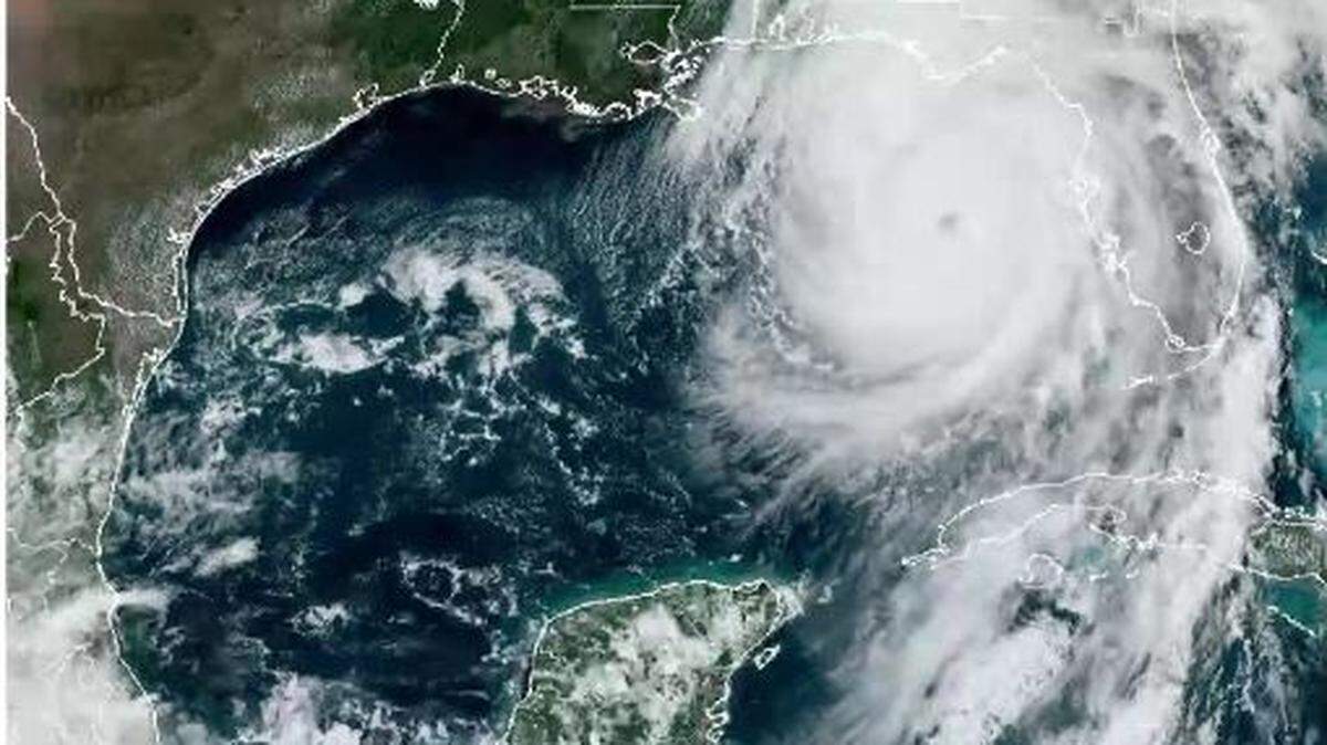
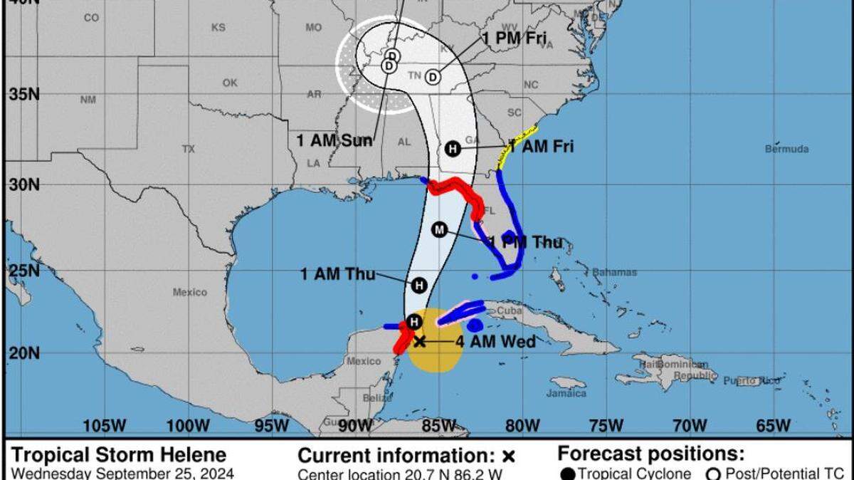
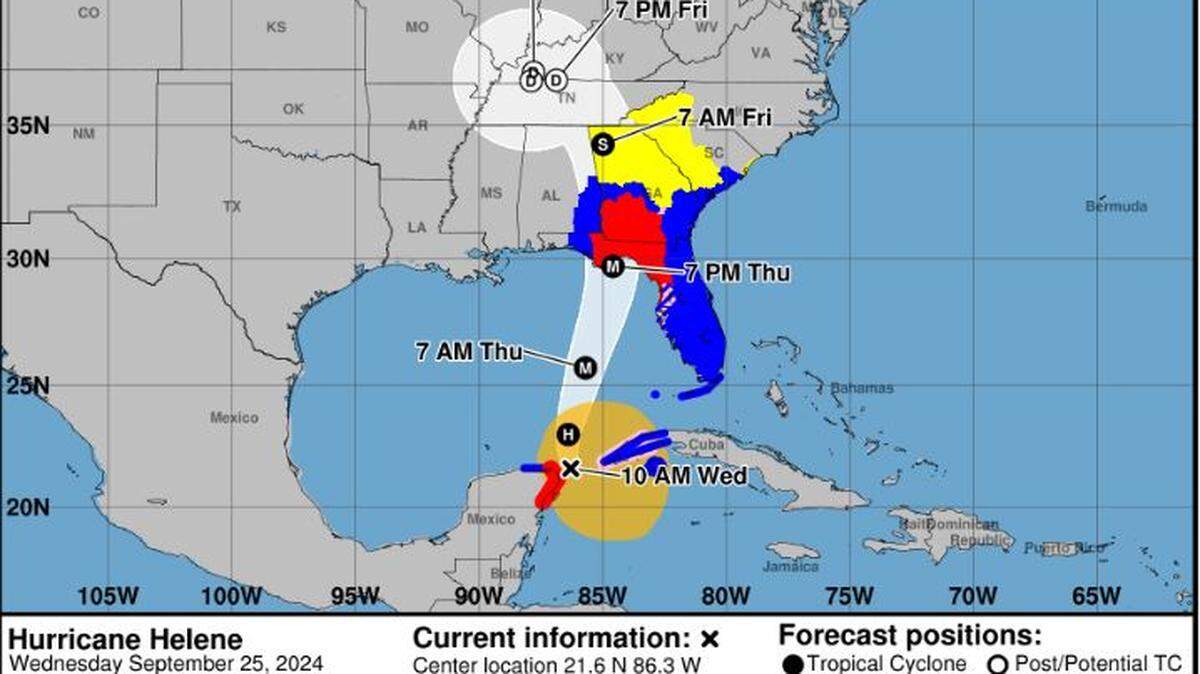
Hurricane Helene, which was 255 miles southwest of Tampa, Florida, at 10 a.m. Thursday morning and packing 105 mph wind speeds, strengthened into a Category 2 storm overnight.
Helene was moving toward the north-northeast at 14 mph and will continue to as the system significantly increases speed over the next 24 hours. The storm will then move across eastern Gulf of Mexico later Thursday and cross the Florida Big Bend coast in the evening or early Friday morning, according to the National Hurricane Center.
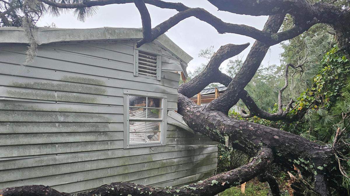
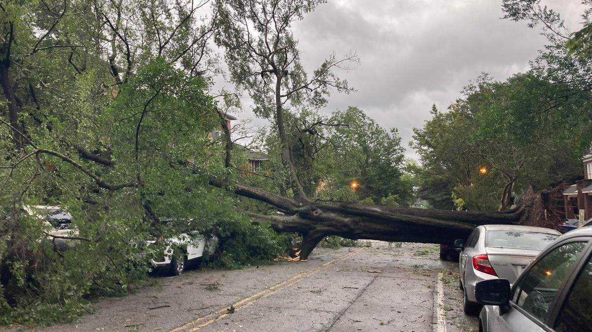
Thursday morning, Beaufort County awoke to the alert of a tornado warning, meaning a tornado had been spotted from the ground or detected by radar. At 7:13 a.m., a severe thunderstorm capable of producing a twister was spotted near Bluffton, moving north at 25 mph, the National Weather Service said in its 7:18 a.m. alert.
The alert expired at 7:45 a.m., but a tornado watch was issued about an hour later. The tornado watch is set to expire at 9 p.m.
Current advisories for the county:
- Tropical storm warning, expires 7:15 Thursday.
- Tornado watch, expires 9 p.m. Thursday
- High surf advisory, expires 8 p.m. Friday
- Rip current advisory, expires 8 p.m. Friday
Hurricane Helene will “rapidly strengthen” over the eastern Gulf of Mexico and become a “major hurricane” Thursday, the NHC said. The large and powerful storm system is likely to bring strong winds, heavy rain and rough seas to the Lowcountry.
Forecasters said Helene is a large system — its wind field is expected to span 400 miles — and will have impacts reaching “well outside/east of the tracking cone.” The system’s wind field “is forecast to be larger than 90% of hurricanes,” said John Morales, a hurricane specialist for NBC5.

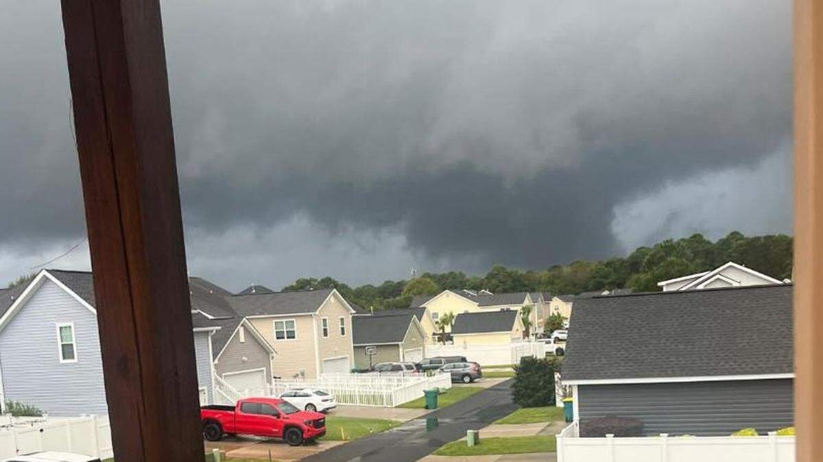
Tornadoes
The Storm Prediction Center has identified a slight risk of severe weather for areas south and east of Interstate 20, and an enhanced risk — level 3 of 5 — for the far southern part of the state.
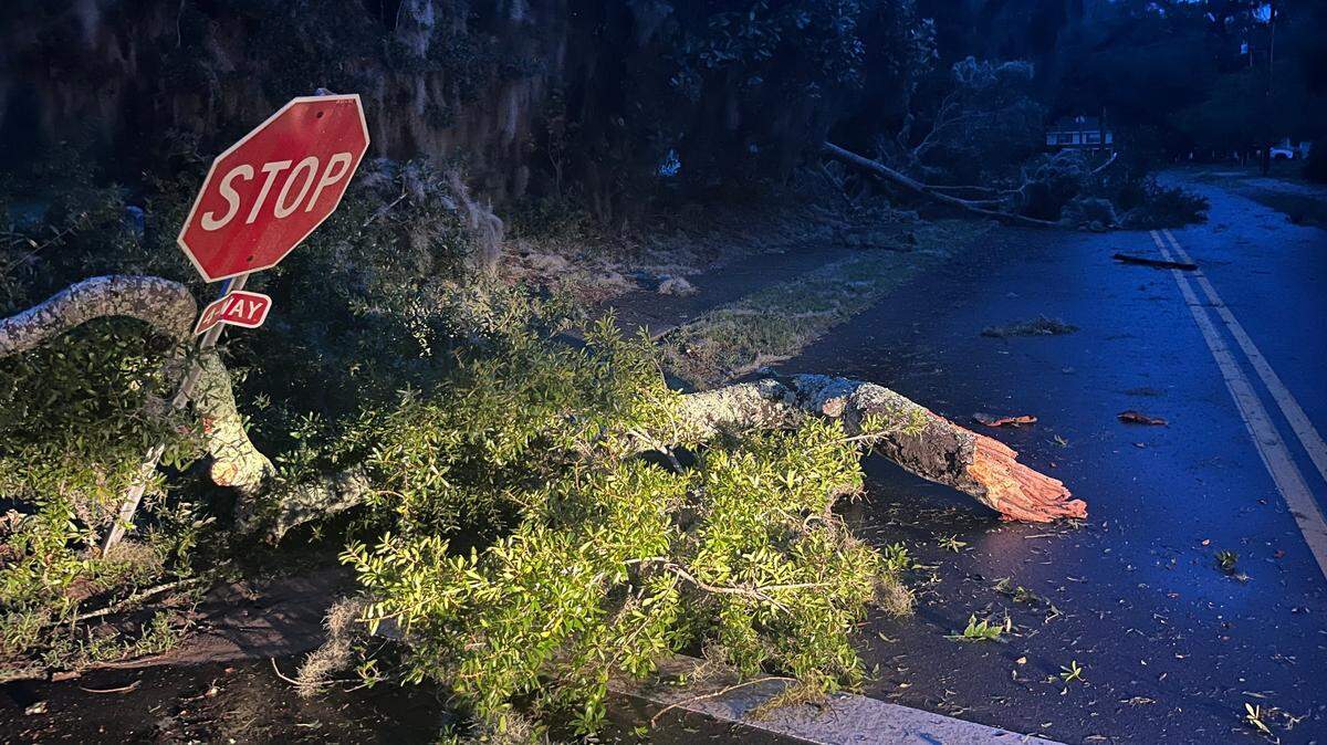
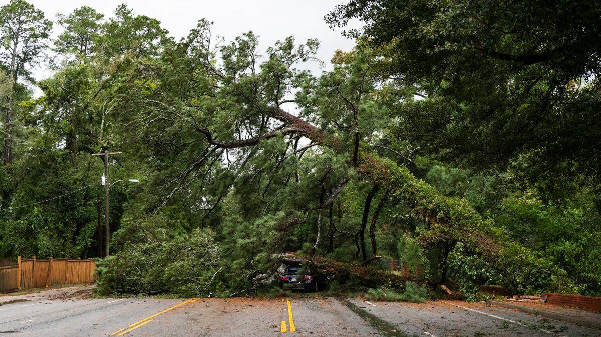
During an NWS briefing Wednesday, Meteorologist Ron Morales said tornadoes are the greatest threat Beaufort County could get from Helene. The area has the potential to get “many tornadoes.” The highest level of tornado activity is expected Thursday evening and overnight. The greatest threat for tornadoes will be within stronger rain bands, Morales said.
“We expect the radar to get a lot busier a lot busier later tonight and certainly tomorrow, as we start getting into the actual rain bands of circulation,” Morales said Wednesday evening.
Frank Strait, the state’s severe weather liaison, said a tornado outbreak at night is “never a good thing,” as people are usually sleeping and miss warnings.
“It’s important to have tornado preparations in place ahead of Helene,” Strait said. “Decide on your best shelter area in advance, as you might not get much lead time. Tropical tornadoes often hit fast without much lead time on warnings.”
Wind
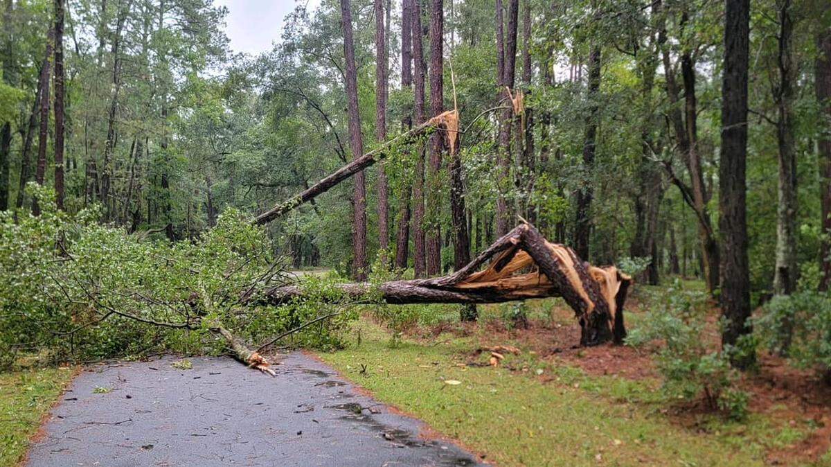
Winds driven by Hurricane Helene could reach between 39 and 57 mph beginning Thursday afternoon in the Lowcountry, leading to downed and/or uprooted trees, isolated-to-scattered power outages and debris-filled roads, according to the NWS.
Gusts could reach up to 61 mph in Beaufort on Thursday evening.
Rainfall
Beginning 8 p.m. Wednesday and lasting through Friday morning, up to 4 inches of rain could fall in Beaufort County.
Storm surge
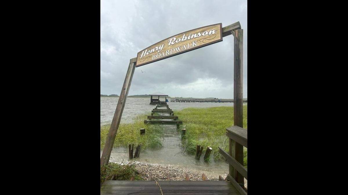
Storm surge between 1 and 3 feet above ground was possible starting Thursday afternoon and lasting through the evening. The surge could cause localized flooding in low-lying areas, washing of streets and roads near the coast and minor-to-moderate beach erosion.
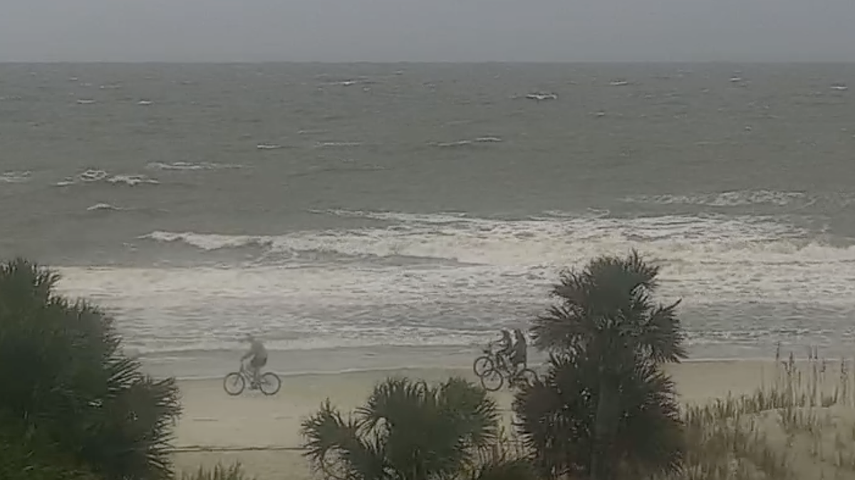
On Thursday and into Friday morning, there will be a threat of high surf and deadly rip currents, the NWS said. Seas could build 6 to 15 feet, with 9 to 17 feet as the highest. Winds and wind gusts of up to 55 knots are possible.
This story was originally published September 26, 2024 at 8:34 AM.


.jpg)