Beaufort County under tropical storm watch as Helene approaches. Here’s impacts, timing

READ MORE
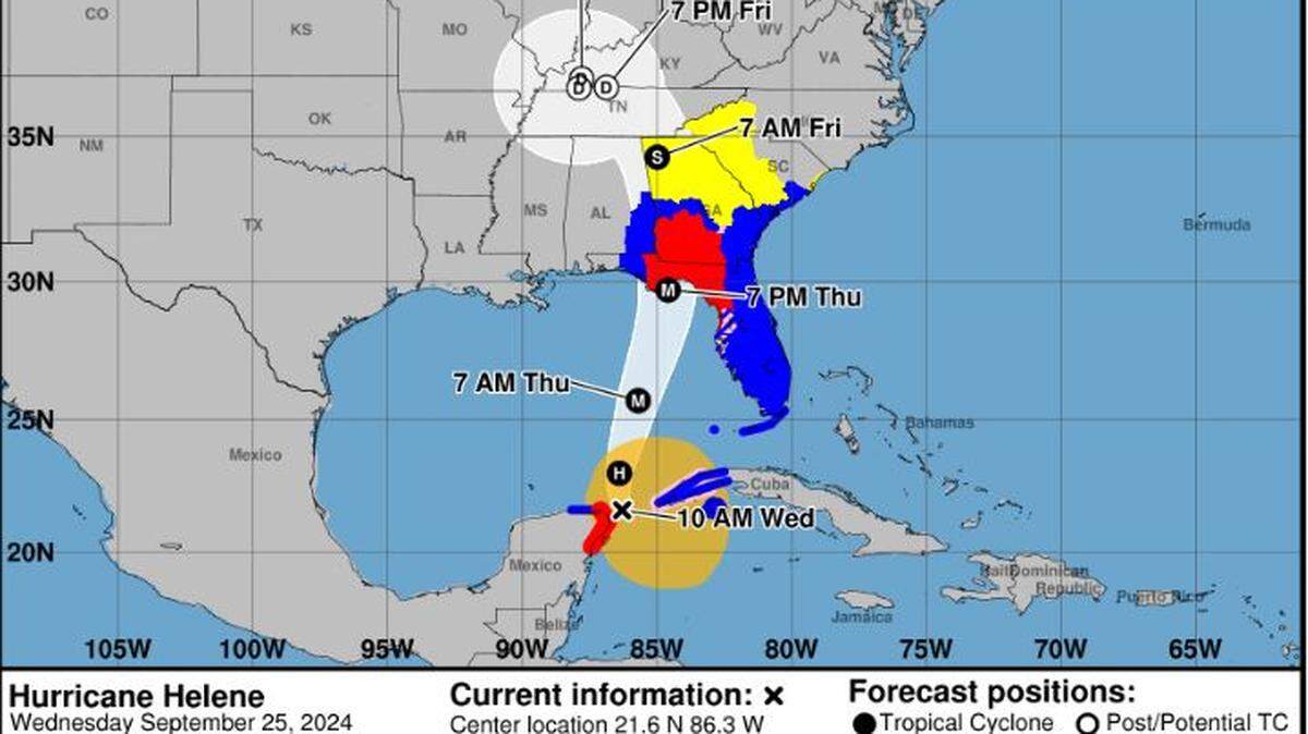
Hurricane Helene
Expected to reach Florida’s Big Bend region late Thursday, the predicted incoming impacts for Hurricane Helene triggered a tropical storm watch for the Lowcountry.
Expand All
Expected to reach Florida’s Big Bend region late Thursday, the predicted incoming impacts for Hurricane Helene triggered a tropical storm watch for the Lowcountry.
The watch means tropical storm-force winds are possible somewhere in the area — Beaufort, Bluffton and Hilton Head Island — within the next 48 hours.
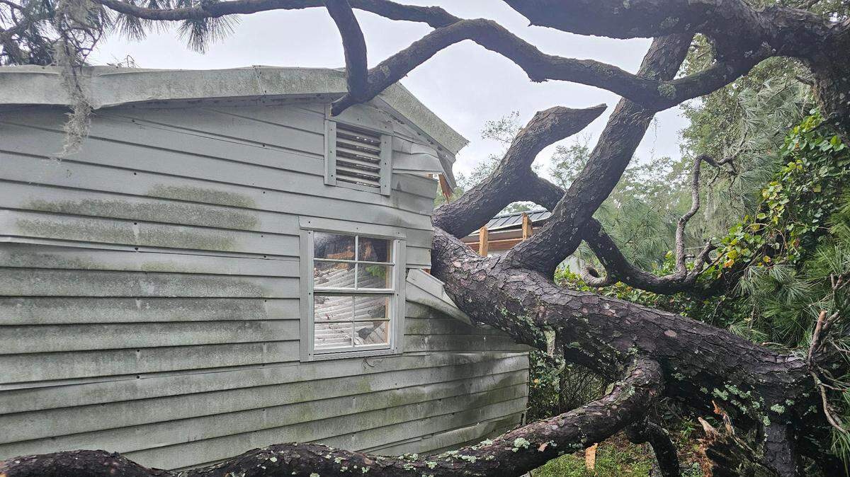
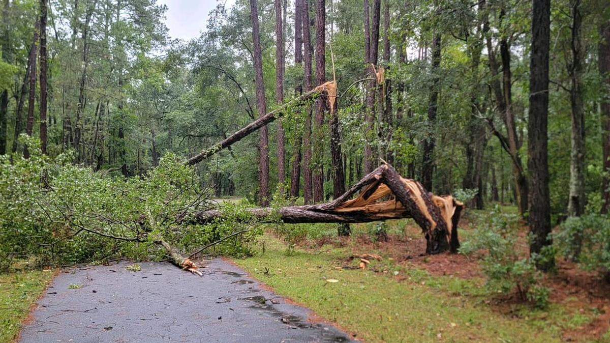
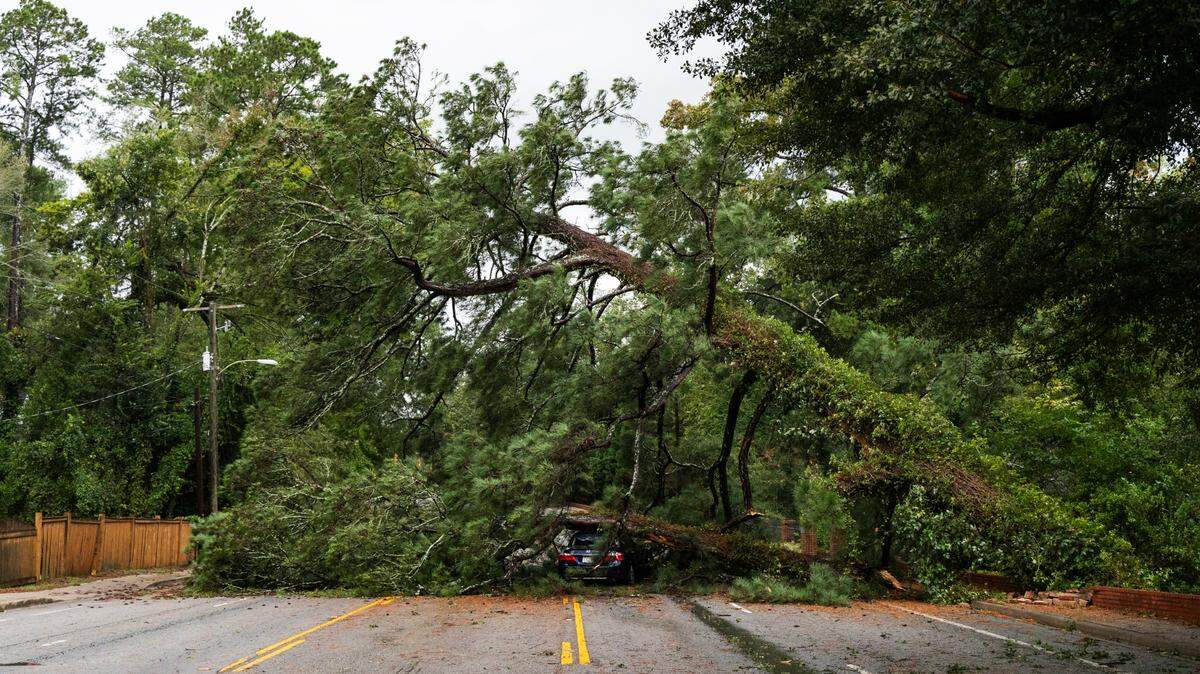
Beginning Thursday afternoon, winds driven by Hurricane Helene could reach between 39 and 57 mph, leading to downed and/or uprooted trees, isolated-to-scattered power outages and debris-filled roads, according to the National Weather Service’s Charleston Office.
“Still NO probabilities for Hurricane Force winds in our area, BUT watch trends,” the NWS said in its 6 a.m. Wednesday briefing.

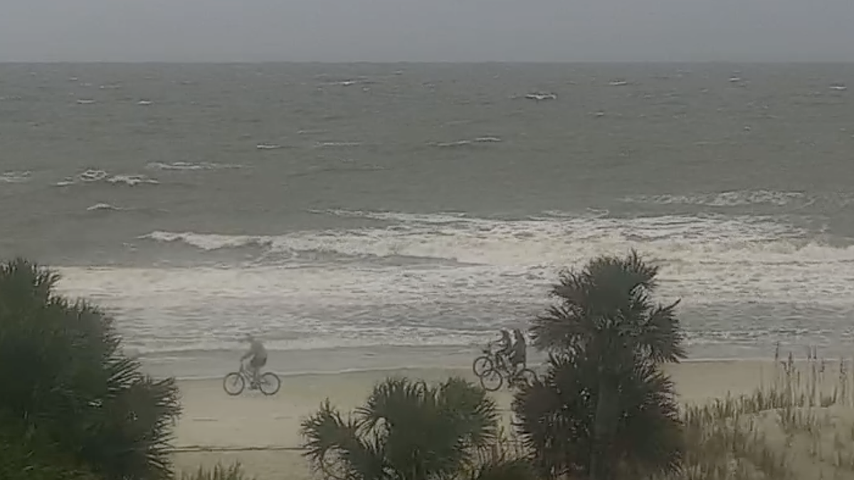
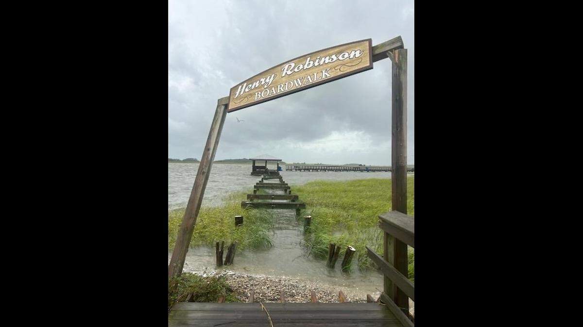
Storm surge between 1 and 3 feet above ground is possible starting Wednesday, with the greatest impacts Thursday, which could cause localized flooding in low-lying areas, washing of streets and roads near the coast and minor-to-moderate beach erosion. Beginning 8 p.m. Wednesday and lasting through 8 p.m. Friday, up to 3 inches of rain could fall in Beaufort County.
On Thursday and into Friday morning, there will be a threat of high surf and deadly rip currents, the NWS said. Seas could build 6 to 15 feet, with 9 to 17 feet as the highest. Winds and wind gusts of up to 55 knots are possible.
In Beaufort County, mainly Thursday, there is the potential for “many” isolated-to-scattered tornadoes associated with Helene’s stronger rain bands.
“This is expected to be a large storm, with impacts reaching well beyond/east of the track cone of uncertainty,” the NWS said. “Focus attention on expected impacts, NOT the centerline of the forecast track.”
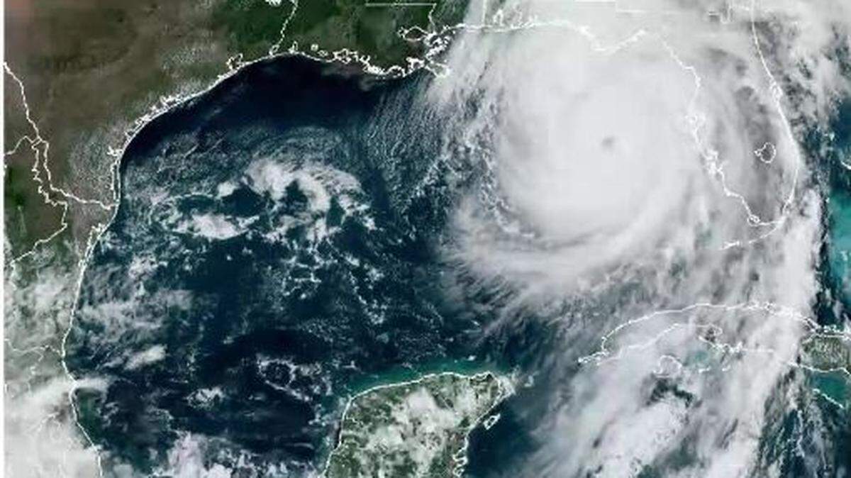
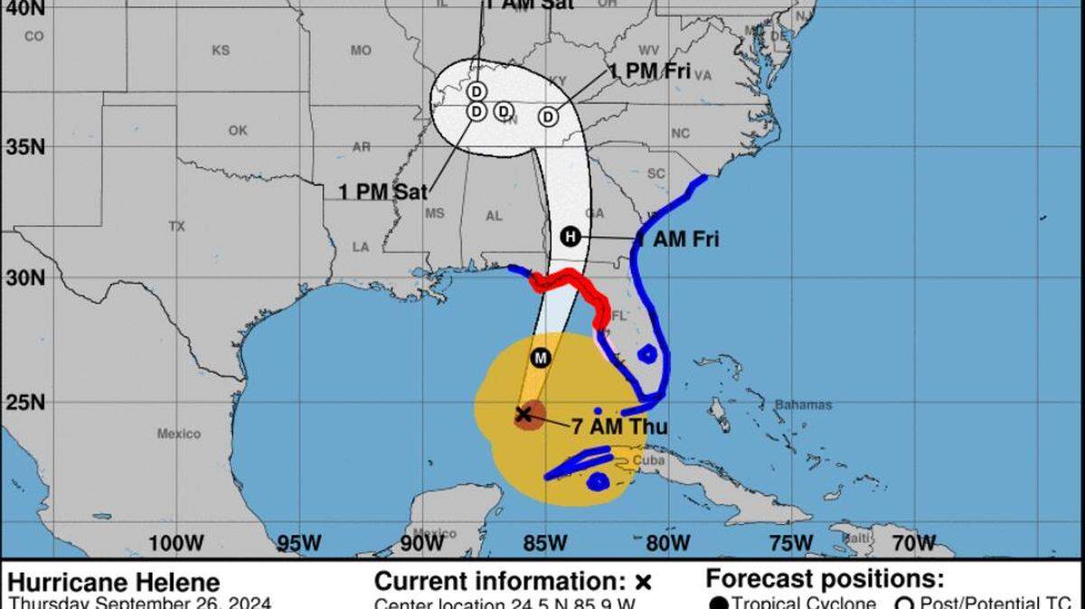
At 10 a.m. Wednesday, Hurricane Helene was 500 miles south-southwest miles of Tampa, Florida, moving north-northwest at 10 mph and packing 80 mph winds, according to the National Hurricane Center.
Helene’s westward motion should continue through Wednesday morning, then make a northward motion later Wednesday and continuing through Friday. The center of Helene will pass near the northeastern coast of the Yucatan Peninsula on Wednesday morning, churn across the eastern Gulf of Mexico on later Wednesday and Thursday, and reach the Big Bend coast of Florida late Thursday, according to NHC computer models.
Forecasters with the NHC said Helene will “rapidly strengthen” over the eastern Gulf of Mexico and become a “major hurricane” Thursday.
This story was originally published September 25, 2024 at 8:24 AM.


.jpg)