LIVE UPDATES: Tropical storm warning extended for Beaufort County as Debby moves offshore
READ MORE
Tropical Storm Debby
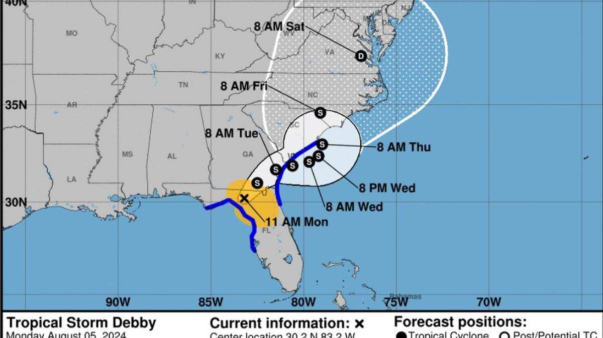
Tropical Storm Debby made landfall August 5 as Category 1 storm in Florida’s Big Bend region. As it moves up the Southeast Coast, the system could dump historic rainfall in Beaufort County.
Expand All
Click here to access Wednesday’s live updates.
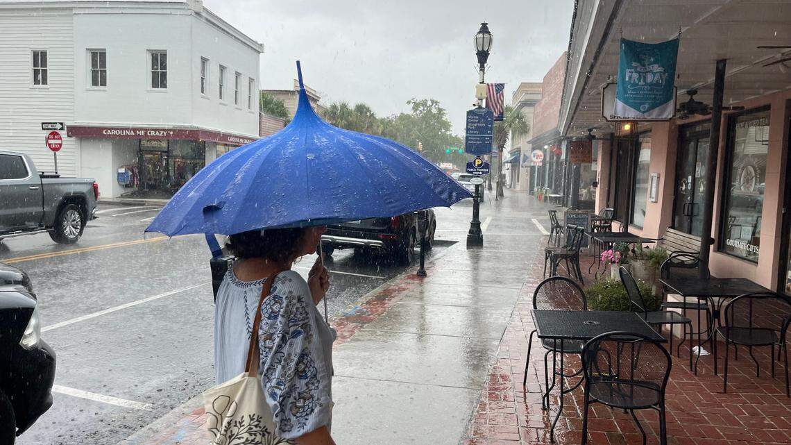
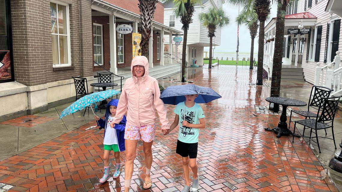
As Tropical Storm Debby inched into Georgia on Monday night, rain bands associated with the slow-moving system showered Beaufort County with heavy rainfall and wind speeds kicked up, triggering flash flood and tornado warnings.
On Tuesday morning, before the sun rose to more visibly show signs of damage and flooding, rain continued to ebb and flow in the Lowcountry. Rain remains the most extreme impact through Thursday, the National Weather Service said. Forecasters predicted rain totals through 8 a.m. Friday could potentially amount to as high as 20 to 25 inches, the service said.
Over the past two days, many areas have measured between 8 and 12 inches of rain, the service said. The NWS expected in addition to the already fallen rain, the Lowcountry could get an additional 3 to 6 inches, with the possibility of up to 8 inches locally.
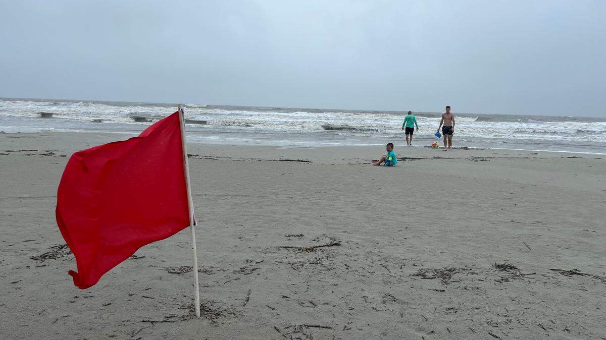
The greatest threat for storm surge inundation, between 1 and 2 feet, begins Tuesday and last through Thursday, which could cause flooding of coastal streets and roadways, and minor-to-moderate beach erosion. If tropical storm-force winds blow through Beaufort County, they’d be likely to do so Wednesday and into the evening. Tropical storm wind gusts, between 39 and 57 mph, are possible for the area through Wednesday, the NWS said.
The county was under the following watches and warnings:
- Flash flood warning until 8 p.m.
- Tropical storm warning until 4 a.m. Wednesday
Flood warning 7:45 a.m. Wednesday
Here are the latest updates:
6:30 p.m. NWS briefing
During its second briefing Tuesday, the NWS said flooding rainfall and coastal flooding/storm surge impacts had decreased. Storm surge inundation dropped from 2 to 4 feet to 1 to 2 feet. The service discontinued Beaufort County’s storm surge warning.
Additional rainfall totals through Friday morning also decreased to amount between 3 and 6 inches, with the potential for 8 inches locally.
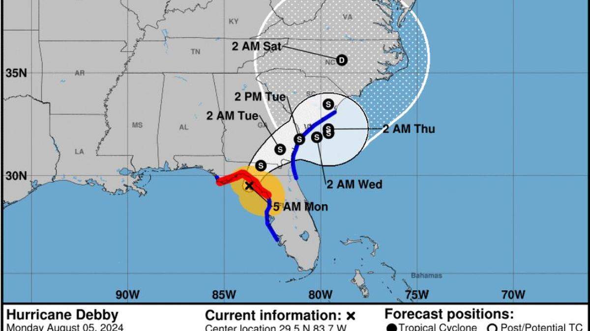
Debby was emerging off Georgia’s Chatham County coast Tuesday evening, and forecasters expected the storm to slowly move east into Atlantic waters through early Wednesday. The NWS said Debby was still expected to turn north late Wednesday, with a second landfall along the South Carolina coast early Thursday.
“Debby (is) not expected to reach hurricane strength before second landfall,” the service said.

5:35 p.m: Town of Hilton Head Island update
Assessments of the Hilton Head revealed 15 downed trees, localized flooding, and general debris across the island, according to a town news release.
Town administrative offices and park facilities will remain closed Wednesday.
4 p.m: Beaufort Memorial to resume services
All outpatient services, including physician clinics, are expected to resume as normal Wednesday, according to Beaufort Memorial officials. Hospital visiting hours will resume at 10 a.m. Wednesday but, until that time, entry into the hospital will only be through the emergency room entrance.
- Beaufort Memorial physician practices will reopen at 8 a.m.
- All three Express Care & Occupational Health clinics will open at 8 a.m.
- Outpatient departments, including outpatient laboratory services will reopen with normal hours
- Surgery schedules have resumed and nursing staff is contacting patients with scheduled elective surgeries at the hospital and the Beaufort Memorial Surgery Center with pre-operative instructions
- Radiation therapy, chemotherapy and infusion services will resume at 8 a.m.
- Patient Financial Services (Billing) and Medical Records will reopen at 8 a.m.
- LifeFit Wellness Center will reopen at 5 a.m.
3:45 p.m: BJWSA update about floodwaters
Beaufort-Jasper Water & Sewer Authority cautioned residents to stay away from floodwaters, adding that people should not enter, contact or consumer floodwater.
BJWSA crews that conducted storm damage assessments reported flooded sanitary sewer infrastructure (pump stations and other manholes), according to an authority news release. Infrastructure in Bluffton, Hardeeville, and Burton were impacted the most in the following locations:
- Pump Station at 84 Buckwalter Parkway in Bluffton
- Manhole at 853 Rocking Horse Lane in Bluffton
- Manhole at 613 Coopers Lane S. in Bluffton
- Manhole at 3 Wood Eden Court in Bluffton
- Manhole at 100 Blacksmith Circle in Beaufort
- Manhole at 122 Stiney Funeral Home Road in Hardeeville
According to BJWSA, when heavy flooding happens, all stormwater should be treated as if it has come into contact with sanitary sewage. Floodwaters should be considered contaminated. Once stormwater recedes and BJWSA crews can gain access, they will continue evaluations and address necessary repairs.
3:05 p.m: Grocery store updates
- The Piggly Wiggly in Port Royal, located at 1347 Ribaut Road, is closing at 7 p.m. Tuesday.
- All Publix stores across the county are operating normally
Kroger on Hilton Head Island, located at 2 Shelter Cove Lane is operating at normal hours
- Harris Teeter is operating at normal hours
2:15 p.m: Palmetto Breeze update
All Palmetto Breeze will be suspended through Wednesday, including all Palmetto Breeze commuter routes, weekday routes serving the Beaufort and Port Royal areas, the Bluffton Breeze weekday service in Bluffton and the seasonal Breeze Trolley service on Hilton Head.
A decision for Thursday’s services will be announced Wednesday, according to a news release from the Lowcountry Regional Transportation Authority.
“The uncertainty of the amount and timing of the rainfall and the resulting flood waters dictates that we continue to put the safety of our passengers and operators first by suspending service again on Wednesday,” said LRTA Executive Director Mary Lou Franzoni.
2 p.m: Fire rescue incidents
The Hilton Head Island Fire Rescue responded to 57 incidents from 8 a.m. Monday to 11 a.m. Tuesday. Sixteen were reports of fallen trees and seven were fire alarm malfunctions, both due to impacts from Tropical Storm Debby.
1:30 p.m: Beaufort County shelters
Two shelters in Beaufort County are open to the public, according to an advisory from the Beaufort County Sheriff’s Office.
Beaufort: Battery Creek High School, located at 1 Blue Dolphin Drive
Bluffton: Bluffton Middle School, located at 30 New Mustang Drive
Both Beaufort County shelters have limited resources and medical resources are not available, the advisory said. Pets are not allowed at either shelter. Be prepared to supply your own necessities, including food and water. The shelters will remain open pending updates throughout Tropical Storm Debby.
One shelter in Jasper County remains open.
Ridgeland: Ridgeland Elementary School, located at 250 Jaguar Trail
The shelter is prepared for special needs and is also pet-friendly, the advisory said. If you shelter with your pet, please bring enough food, any medicine, a leash, vaccination paperwork, a crate if possible, blankets and toys.
Noon: NWS Charleston weather briefing
Local forecasters said Beaufort County could get an additional 6 to 12 inches of rain on top of what had already fallen by early Tuesday.
During an 11:30 a.m. briefing, NWS Charleston Meteorologist Ron Morales said computer models project Debby would slowly move east and then northward, then shift back toward the Charleston County coast Thursday.
If the storm’s center gets far enough out, Morales said it would be problematic, with the potential for the system to restrengthen into a “minimal” hurricane. However, there is still “some uncertainty” in the storm’s path, Morales said.
If tropical storm-force winds blow through Beaufort County, they’d be likely to do so Wednesday and into the evening. Tropical storm wind gusts, between 39 and 57 mph, are possible for the area through Wednesday, the NWS said.
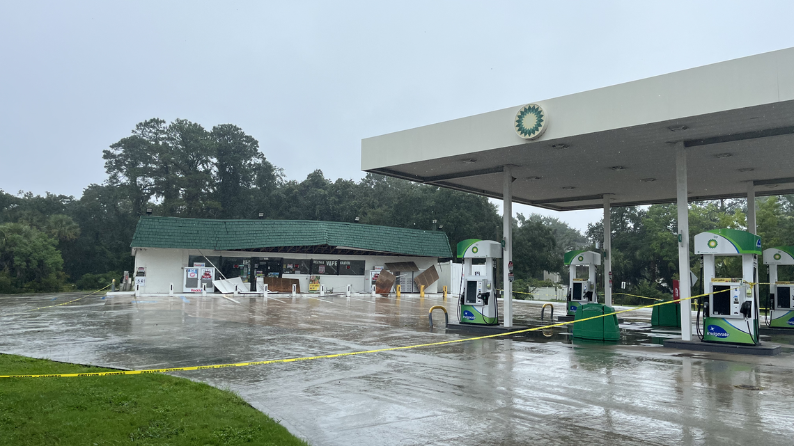
11:30 a.m: Gas station roof collapse
A large buildup of water atop the BP gas station near the Hilton Head bridges caused the roof to collapse. No one was inside at the time and no injuries were reported, according to Stephen Combs, a spokesperson for the Bluffton Township Fire District.
As of Tuesday morning, officials were not sure what time the roof had collapsed. The minimart was constructed in 1984.

11:15 a.m: Hilton Head Island rain updates
Mid-Tuesday morning, standing water was on the island’s Bay Point Road. Marlin and Greg Clark had been pumping water out of the yard since Monday night and said, because of that, water hadn’t yet entered the house

Sea Pines was clear of flooding according to an Island Packet and Beaufort Gazette reporter who was surveying the island Tuesday.

10:30 a.m. Rainfall totals
Over the past two days, many areas have measured between 8 and 12 inches of rain, the National Weather Service said.
In Beaufort County, the highest rainfall totaled 11.16 inches in Beaufort and the lowest was 3.91 inches on Hilton Head Island, according to the service’s Tuesday morning report.
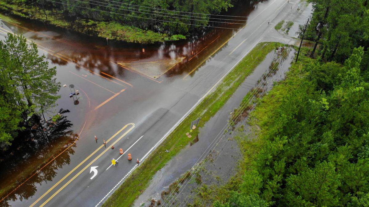
10 a.m: Road closures
Trask Parkway at Kean’s Neck Road has been reduced to one lane northbound and one lane southbound due to flooding.
- Trask Parkway in front of MCAS is likely to flood
- Abberly Point entrance on 170 is not accessible due to flooding
- Burton Wells Road at Middleton Recreation is flooded
- Broad River Boulevard near Lamon Drive in Burton is impacted due to down power lines
- Portions of Kinlock Road in Dale are flooded
- Paige Point Road in Sheldon has downed trees
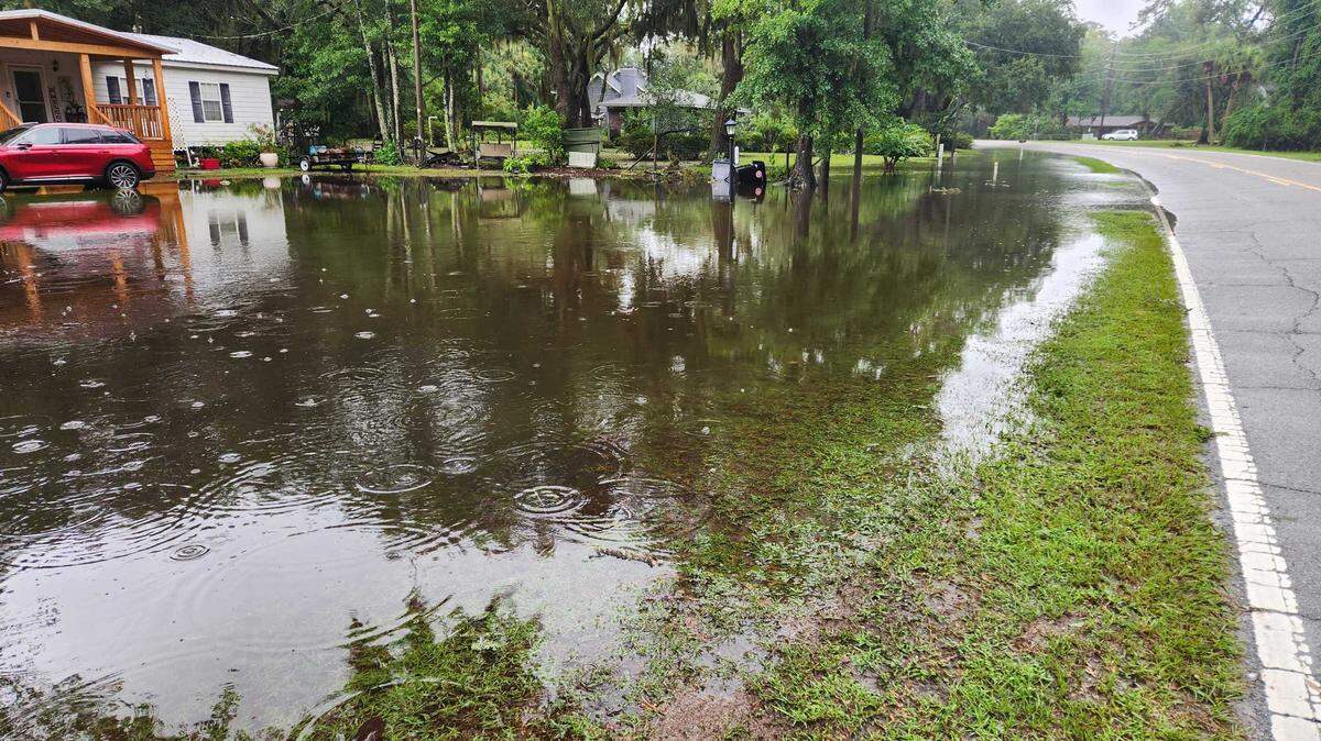
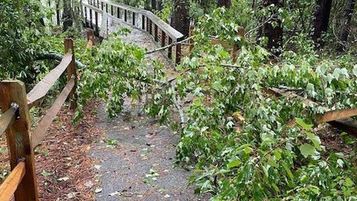
9:40 a.m. Storm damage around the county
While reports of damages from Tropical Storm Debby’s wake are still trickling in, images are emerging of uprooted trees and some significant flooding.
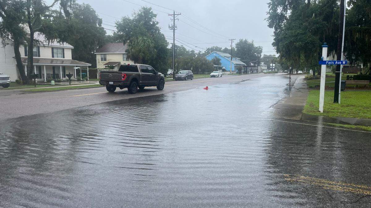
Along Paris Avenue, the street that runs through the heart of Port Royal’s downtown, water had pooled significantly Tuesday morning.

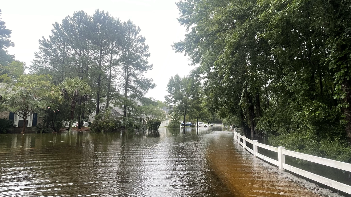
The Alljoy neighborhood in Bluffton had considerable flooding along streets and in residents’ yard.

“This is barely just the beginning of a little rainstorm,” an Alljoy community member Mia Hughey said about Monday’s rainfall. “So trying to get anywhere is going to be really difficult. It’s going to be impossible.”

On Hilton Head Island, a large tree uprooted and fell in front of a home at Moss Point.
.jpeg "image0 (2).jpeg")
In Port Royal, on Old Shell Point Road, a felled tree nearly missed the home, instead falling onto a covered golf cart parked in front of it.

8:35 a.m: Flooded areas in Bluffton
- Bluffton Park: Red Cedar Street/3rd & 4th Avenue — lagoon has flooded
- The Farm: Mill Pond Road/Old Bridge Drive
- The Farm: Old Bridge Drive to Traffic Drive
- The Farm: Cattle Runaway/Farm Lake Drive
- School campus/Pinecrest: H.E. McCracken Circle/Pinecrest Drive
8:20 a.m: SAV/HHI Airport update
As of 8:20 a.m., seven flights of the 19 that were leaving were from Savannah-Hilton Head International Airport until have been canceled. Five arrivals have been delayed or canceled, between now and 2:15 p.m.
Lori Lynah, the Director of Marketing & Air Service Development for the airport urges travelers to closely monitor notices from their airlines for up to date information.
8:15 a.m: Jasper County sandbags, convenience center closures
Sand is available in Hardeeville and Ridgeland, according to a county news release. There is a limit to five bags per household. However, if you bring your own sandbags, you may fill 10 bags per household. Bring shovels to fill the sandbags.
- Ridgeland location: 456 Grays Highway
- Hardeeville location: 205 Main St.
County government offices and recycling centers are closed Tuesday, the county said. Conditions will be evaluated later Tuesday about county offices and recycling centers operations for Wednesday.
8:10 a.m: Beaufort County Sheriff’s Office update
Since Monday afternoon, the sheriff’s department had received dozens of storm-related calls with downed trees, downed power lines, and flooded roads, the office said.
“Please DO NOT drive through flooded roads,” it urged. “Remember that saying, “Turn around. Don’t drown”. You never know exactly how deep the flood waters are and they pose danger to you and your safety.”
7: 35 a.m: Jasper County road flooding
Multiple roads are flooded in Jasper County and should be avoided, the county’s emergency services department said.
“We anticipate more area to flood as the storm continues and will update accordingly,” the alert said. “We strongly encourage everyone to avoid being on the roadways unless necessary for you safety and to allow first responders to operate effectively.”
The areas are as follows: I-95 exit 22 ramps, I-95 exit 33 ramps, West Frontage Road, Rice Shire Road, between Bees Creek Road and Coosaw Scenic Drive, North of Salzburg Landing Road, Bees Creek Road, between Rice Shire Road and Kyle Lane Road.
6:55 a.m: Hunting Island State Park closed
Hunting Island State Park closed Tuesday for an undetermined amount of time in response to expected flooding and wind impacts from Tropical Storm Debby.
Park Manager Zabo McCants said Monday that the decision was based on the park’s history of flooding and erosion issues. And, ultimately, the closure will keep the public and park rangers safe, McCants said.
6:30 a.m: County power outages
Overnight, over 10,000 customers in Beaufort County lost power. As of 6:30 a.m. Tuesday, that number was over 2,300, PowerOutage.us’ map showed. Out of Dominion Energy’s over 61,000 customers, 2,180 were without power. About 212 of Palmetto Electric Cooperative’s 54,600 customers did not have electricity.
6:20 a.m: NWS Charleston weather briefing
Potentially historic rainfall totals, likely produce areas of catastrophic flooding through at least Friday morning, were expected, according to the NWS’ Charleston Office’s report at 6 a.m.
Tropical Storm Debby was circulating northeast Tuesday morning, and local meteorologist said the system would then shift east and move off the Georgia coast Tuesday afternoon.
If the storm’s center gets far enough out, NWS Charleston Meteorologist Ron Morales said it would be problematic, with the potential for the system to restrengthen into a hurricane. However, he said, that is not currently in the forecast but it is something the service will continue to watch.
“Whether it emerges off the coast, plus how far and how long... that’s going to impact everything,” Morales said Monday evening. “That’s going to impact the storm surge inundation. That’s going to impact where the heaviest rainfall is and where the strongest winds are.”
6: a.m: 24-hour rainfall totals, damage
Within a 24-hour window, a rain gauge check showed an area of Beaufort got 8.56 inches of rainfall, according to the Community Collaboration Rain, Hail & Snow Network on Tuesday morning.
Monday evening, flood and tornado warnings were extended and re-alerted, particularly for Beaufort and Port Royal. The National Oceanic and Atmospheric Administration’s Storm Prediction Center did not show preliminary storm reports for Monday on early Tuesday morning; however, the website will continue to be updated.
5 a.m: Tropical Storm Debby’s location, wind speed
The slow-moving system was 80 miles southwest of Savannah, Georgia, and moving 7 mph, according to the National Hurricane Center. The storm had sustained wind speeds of 45 mph.
“A slower motion toward the east and then north is expected through Thursday night,” the center’s morning forecast said. “On the forecast track, the center of Debby is expected to move offshore the coast of Georgia later today, drift offshore through early Thursday, and then move inland over South Carolina on Thursday.”
Reporters Chloe Appleby, Mary Dimitrov, Sebastian Lee, Evan McKenna and Karl Puckett contributed to this report.
This story was originally published August 6, 2024 at 6:58 AM.


.jpeg)